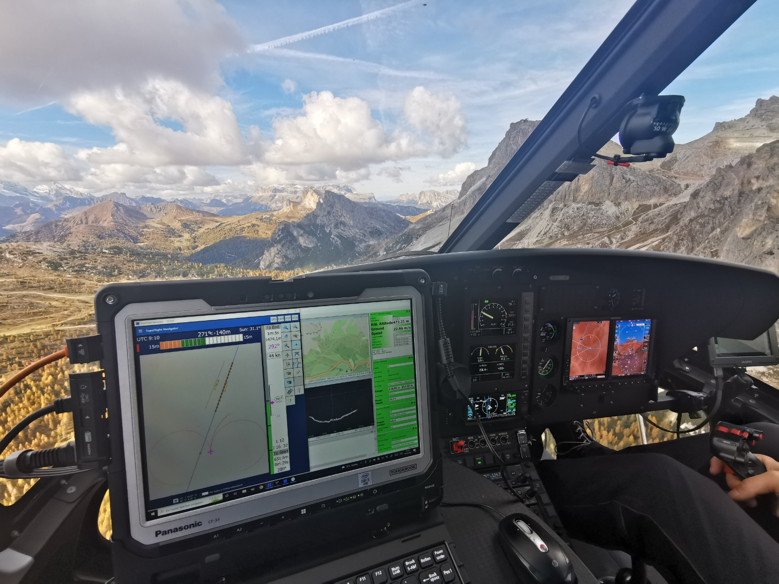
Use our flight management system NAVIGATOR for easy navigation and precise sensor handling during the flight.
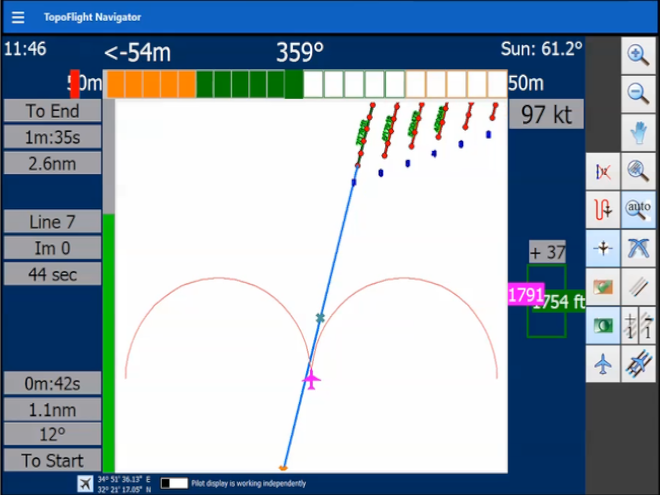
Pilot display
Features the flight lines for precise navigation and provides essential information on altitude, speed, and time.
Sensor control
Our software ensures excellent control and handling of sensors during the flight.
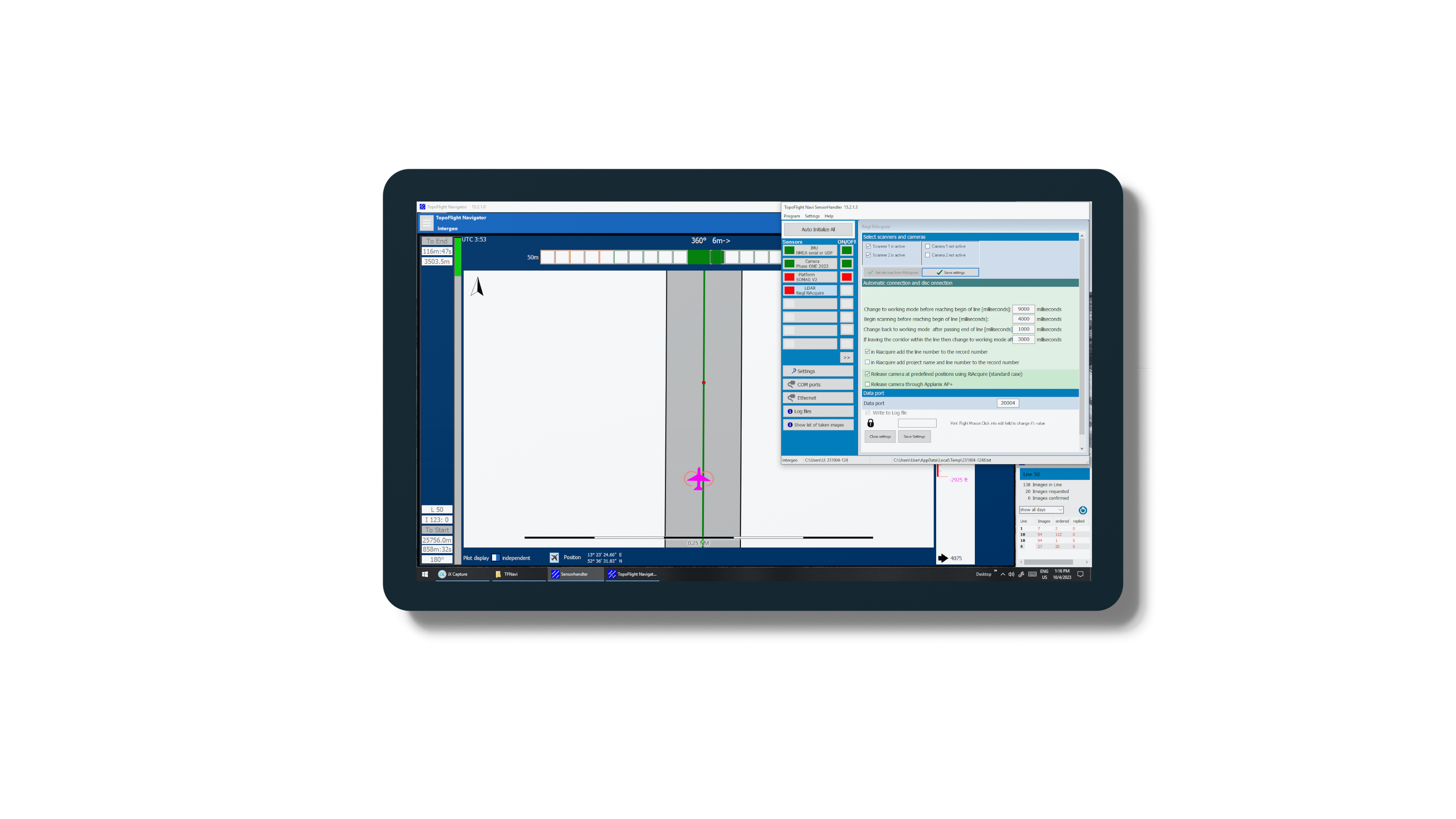
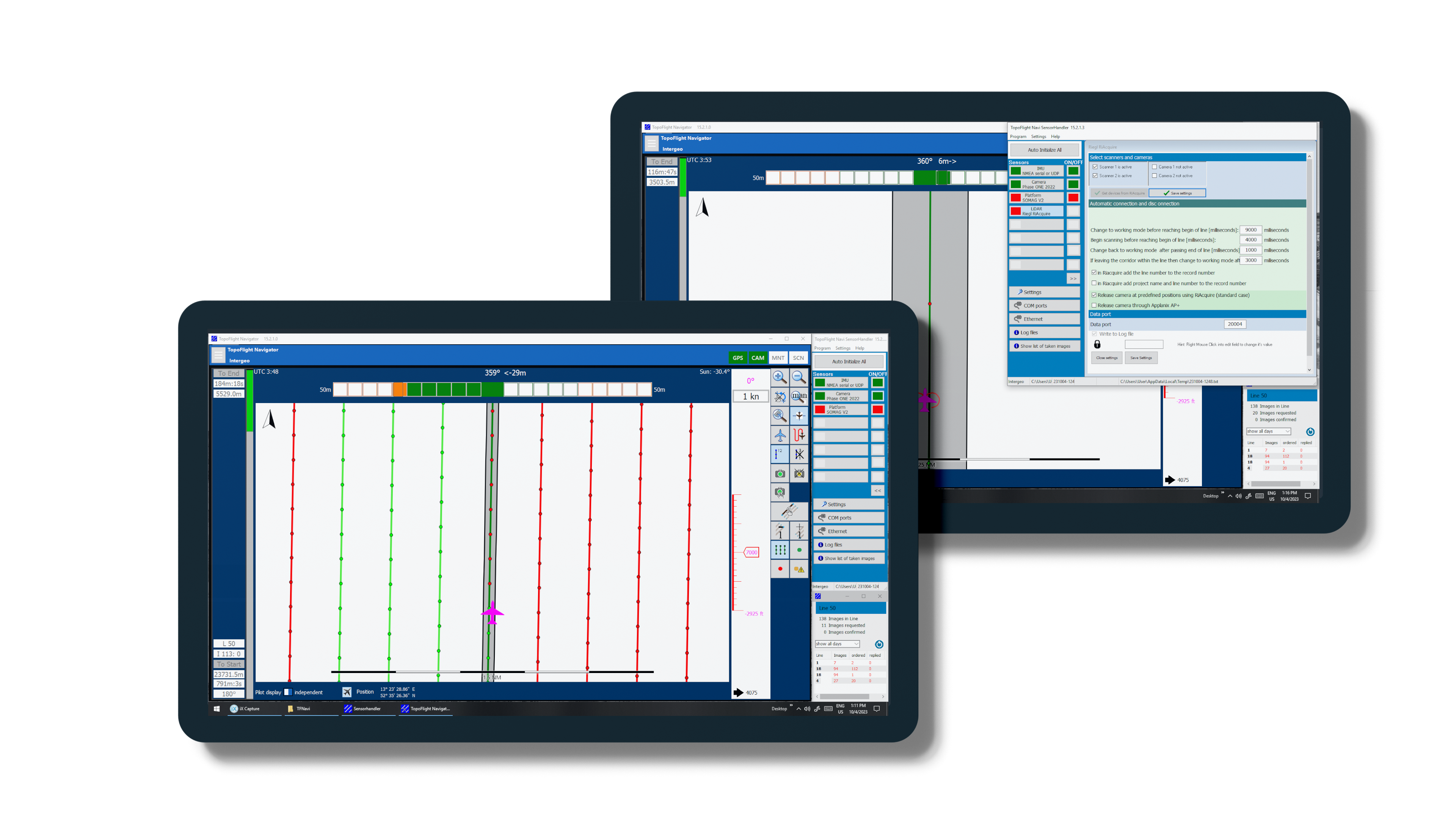
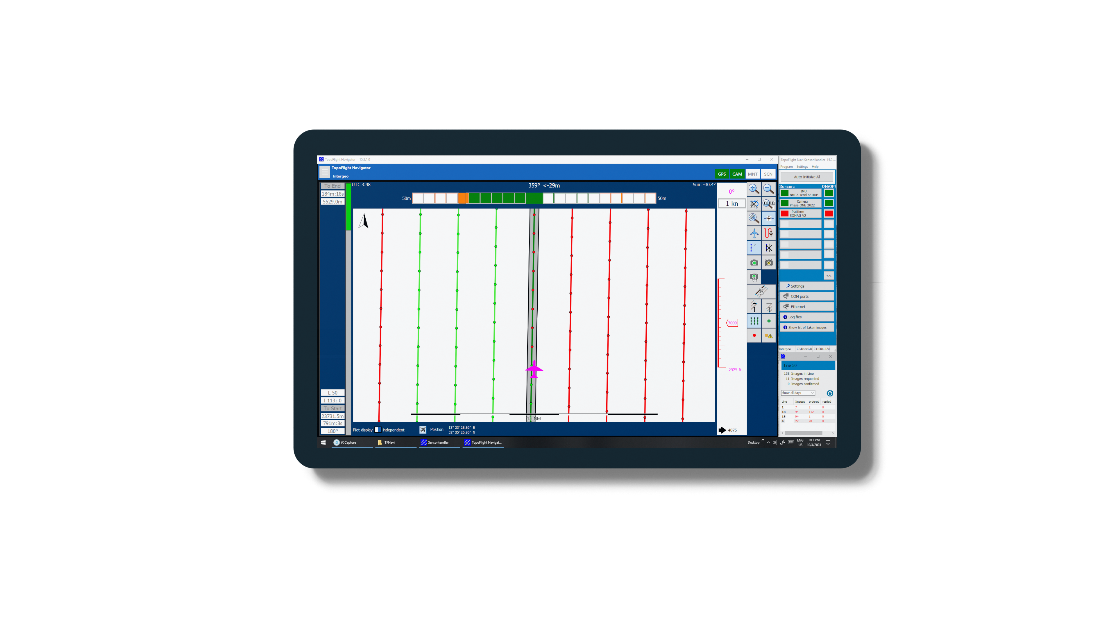
TOPOFLIGHT NAVIGATOR plays a crucial role in aircraft and helicopter navigation during image and LiDAR data acquisition. It operates using predefined flight plans, generated through e.g. TOPOFLIGHT MISSIONPLANNER. These plans ensure efficient flight paths and triggering of the camera at designated positions. Optimal navigation is easily applicable because both the pilot and the operator have their own NAVIGATOR display.
TOPOFLIGHT NAVIGATOR offers a user-friendly interface for monitoring sensors and their operational status during both manual and automatic operation. The system visually represents captured images and flight lines through color-coded symbols on the display, providing instant feedback.
Key features
User friendly and high appealing
The display was developed in collaboration with pilots. Great emphasis was placed on simplicity and usability.
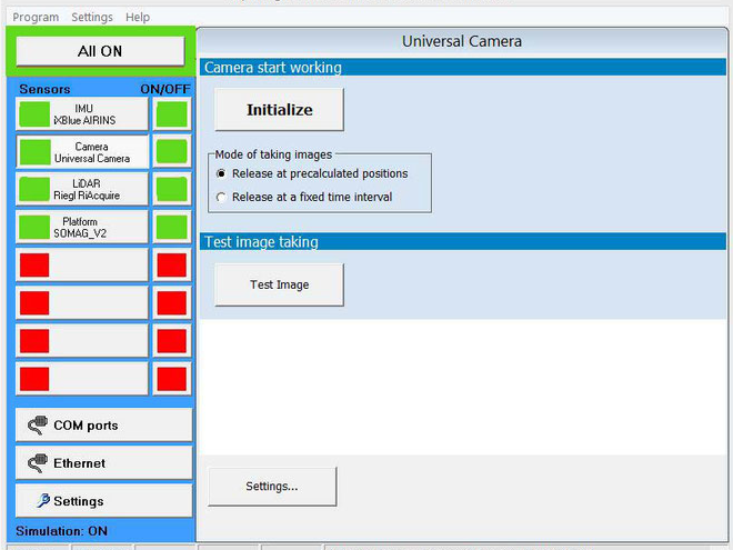
Sensor management
High level of customization for sensors: the attached sensors can easily be selected and stored as sensor set.
Different views
The pilot’s display content is independent from the operator’s display content. (Image: AltoDrones, Italy)
Workflow
Direct implementation of TOPOFLIGHT MISSIONPLANNER projects. No additional exports are required.
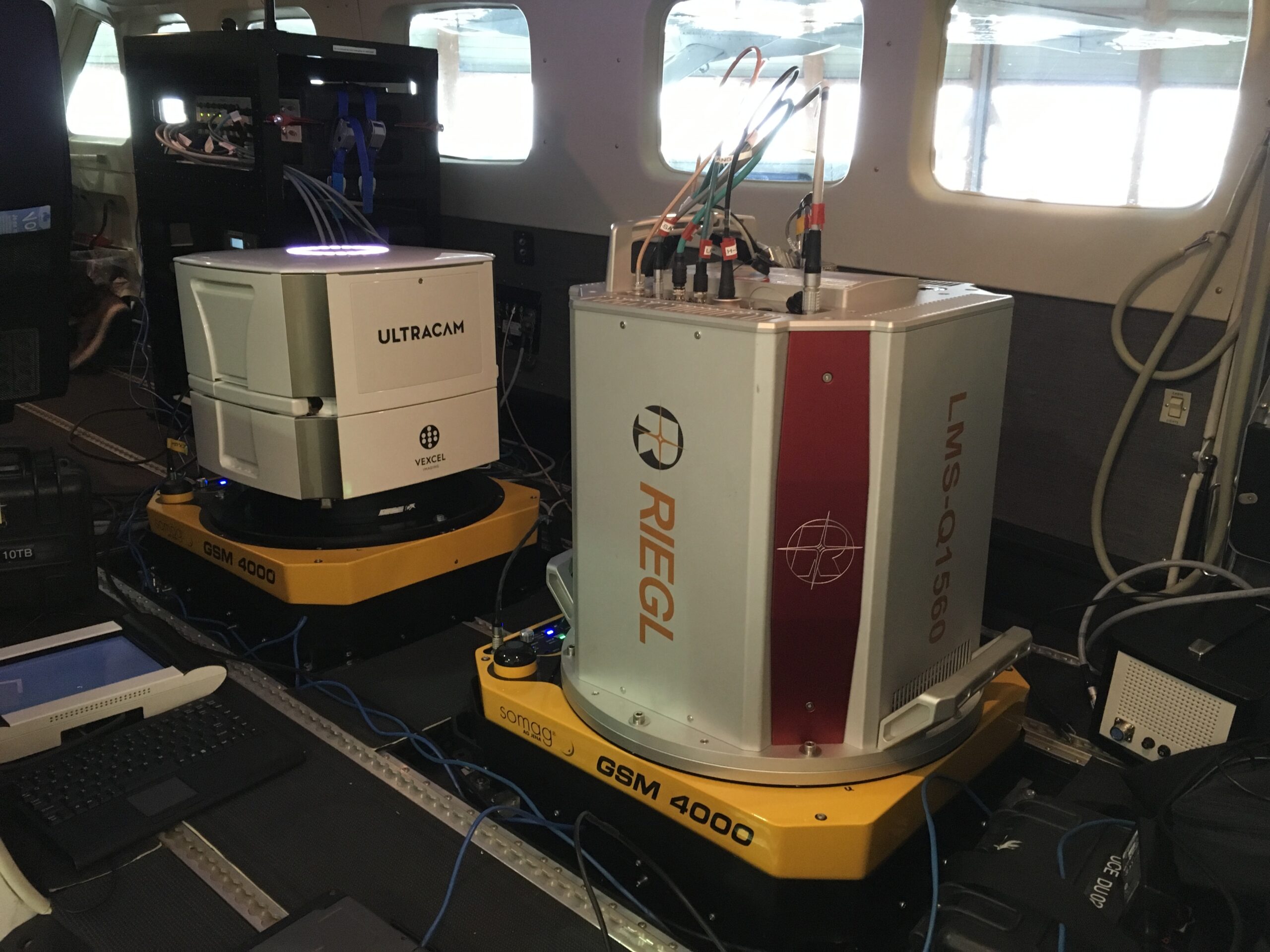
Supported sensors
A large range of frame sensors and LiDAR are supported.
Navigation displays and sensor handling
Customizable
adapt colors, contents, units and symbols to your needs
adapt colors, contents, units and symbols to your needs
Sensor management
configure the sensors in a simple form
configure the sensors in a simple form
Easy to read
See the status of the sensors at a glance
See the status of the sensors at a glance

Customizable pilot display
High level of customization for display contents like colors, symbols, tolerances, units, etc.
High level of customization for display contents like colors, symbols, tolerances, units, etc.

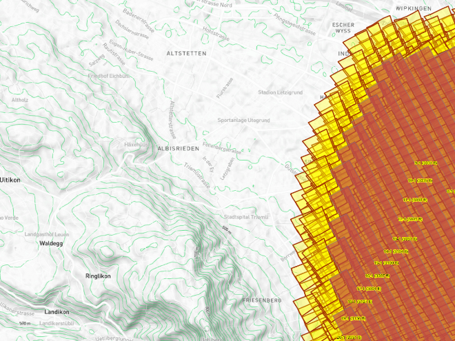
Status visualization
Quick project status visualization: red for „to be done“ and green for „done.“
Quick project status visualization: red for „to be done“ and green for „done.“

Different views
The pilot’s display content is separate from the operator’s display content.
The pilot’s display content is separate from the operator’s display content.

Touch friendly
Big buttons allow fast reaction and simple usage even under harsh conditions and during flight missions.
Big buttons allow fast reaction and simple usage even under harsh conditions and during flight missions.

Sensor management
Enhanced sensor customization for easy selection of attached sensors and storage as a sensor set.
Enhanced sensor customization for easy selection of attached sensors and storage as a sensor set.

Simulation
Simulation mode for software training and sensor testing on the ground.
Simulation mode for software training and sensor testing on the ground.

Workflow
Direct implementation of TOPOFLIGHT projects. No additional exports are required.
Direct implementation of TOPOFLIGHT projects. No additional exports are required.
Resources
Software documentation
You can access our online documentation at this location.
Licensing documentation
Detailed information on the licensing process is available here.
List of supported sensors
Access a comprehensive list of sensors supported by TOPOFLIGHT here.
Download Sentinel RTE
The Sentinel Run-time Environment enables communication between the Sentinel protection key and our software.
Download Sentinel HASP RUS
The Sentinel Remote Update System utility is used to update license data remotely for deployed Sentinel protection keys.
Free trial license
Get a 10-day trial license and test our MISSIONPLANNER for free.
End-User License Agreement (“EULA”)
TOPOFLIGHT grants you the rights described in this EULA provided that you comply with all terms and conditions of this EULA.
Get in touch with us
Your way to the right contact person
Thank you for your interest in TOPOFLIGHT. Do you have any questions about our products?
Feel free to reach out to us anytime using our contact form. We are dedicated to matching your request with the appropriate contact person and ensuring you receive a knowledgeable response.
TOPOFLIGHT AG
Gemeindemattenstrasse 4
CH-3860 Meiringen, Switzerland
Phone: +41 33 972 30 30
info@topoflight.com
Your way to the right contact person
Thank you for your interest in TOPOFLIGHT. Do you have any questions about our products?
Feel free to reach out to us anytime using our contact form. We are dedicated to matching your request with the appropriate contact person and ensuring you receive a knowledgeable response.
TOPOFLIGHT AG
Gemeindemattenstrasse 4
CH-3860 Meiringen, Switzerland
Phone: +41 33 972 30 30
support@topoflight.com
Products
Technology partners and resellers
