TOPOFLIGHT offers a state-of-the-art software suite for efficient design of flight plans, navigation and in-flight sensor handling.
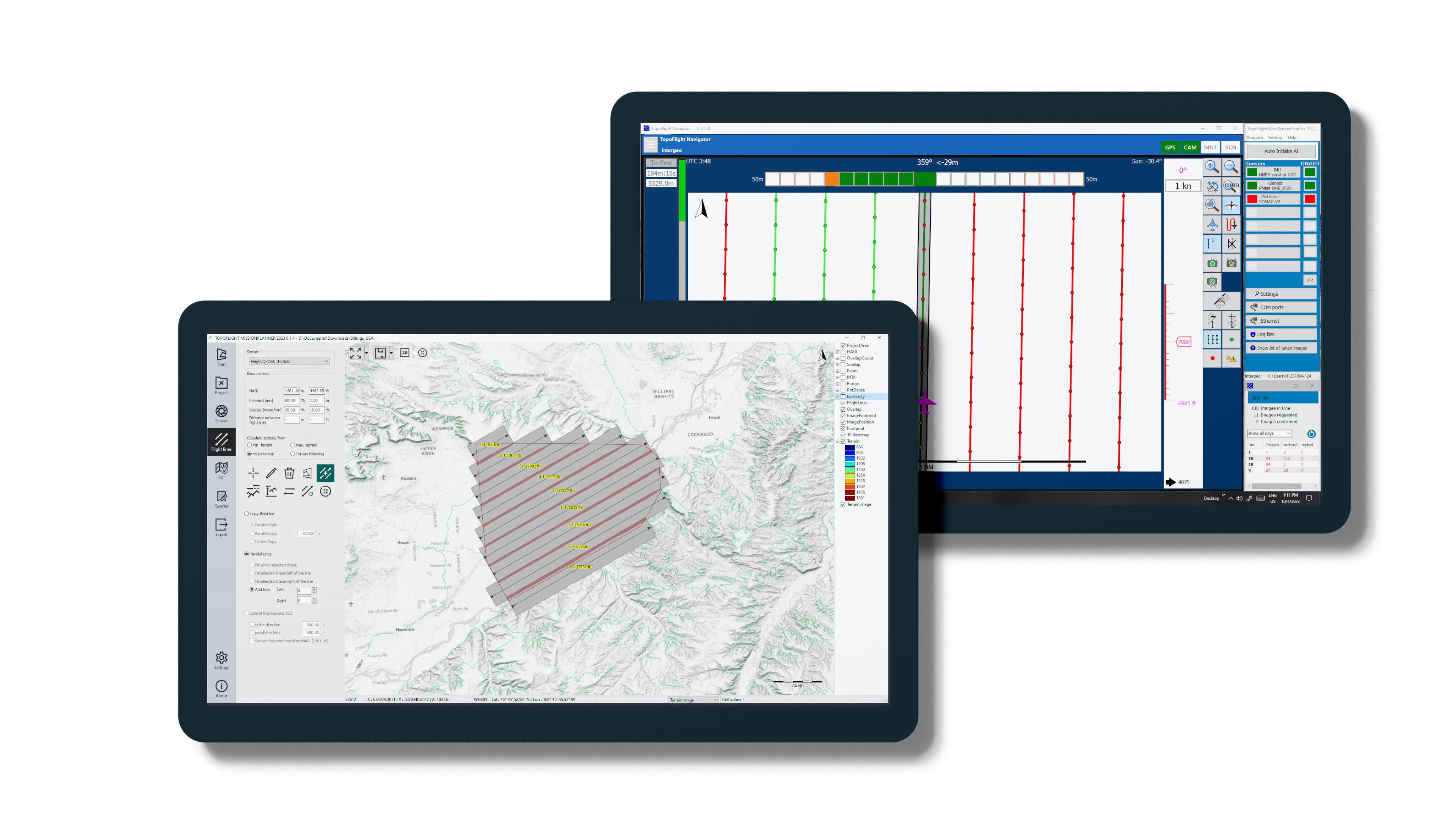
MISSIONPLANNER
create efficient and optimized flight plans
Fast and interactive software to create flight plans according to your specific requirements, even in challenging varied terrain.
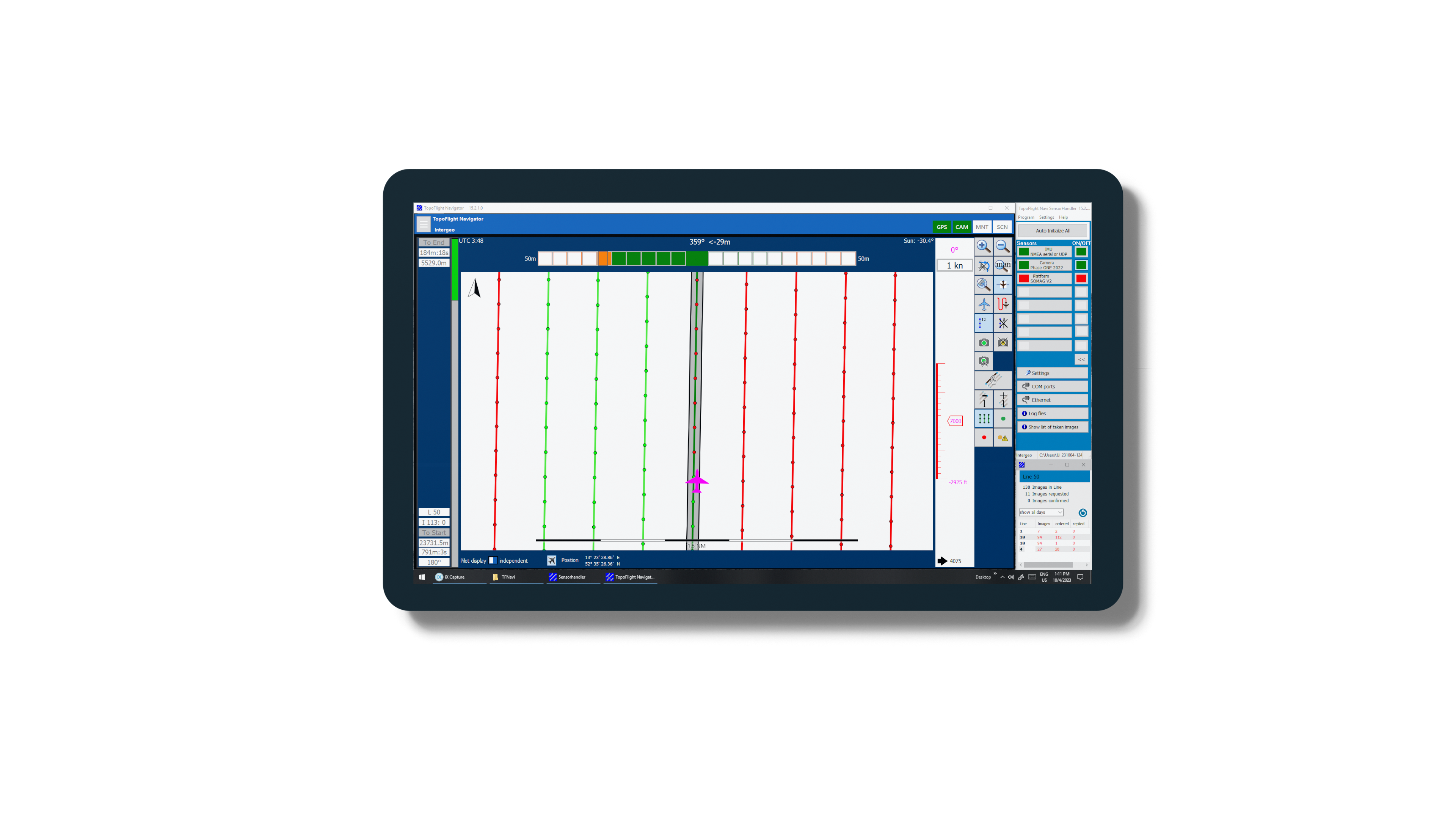
NAVIGATOR
manage your flight
Use our flight management system NAVIGATOR for easy navigation and precise sensor handling during the flight.
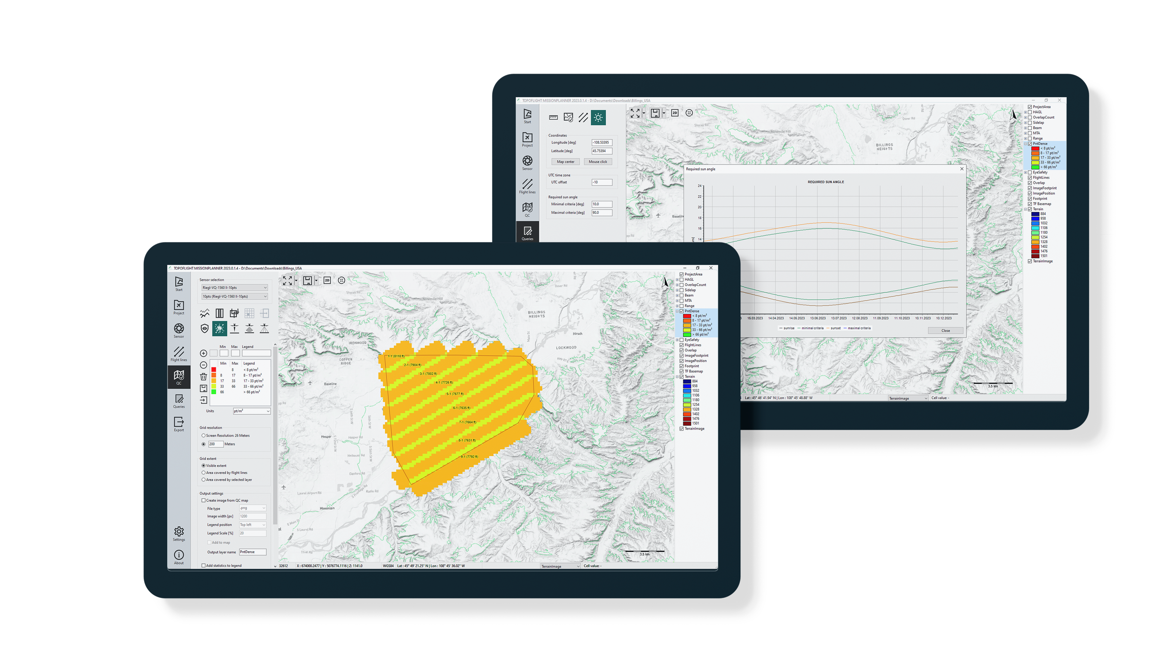
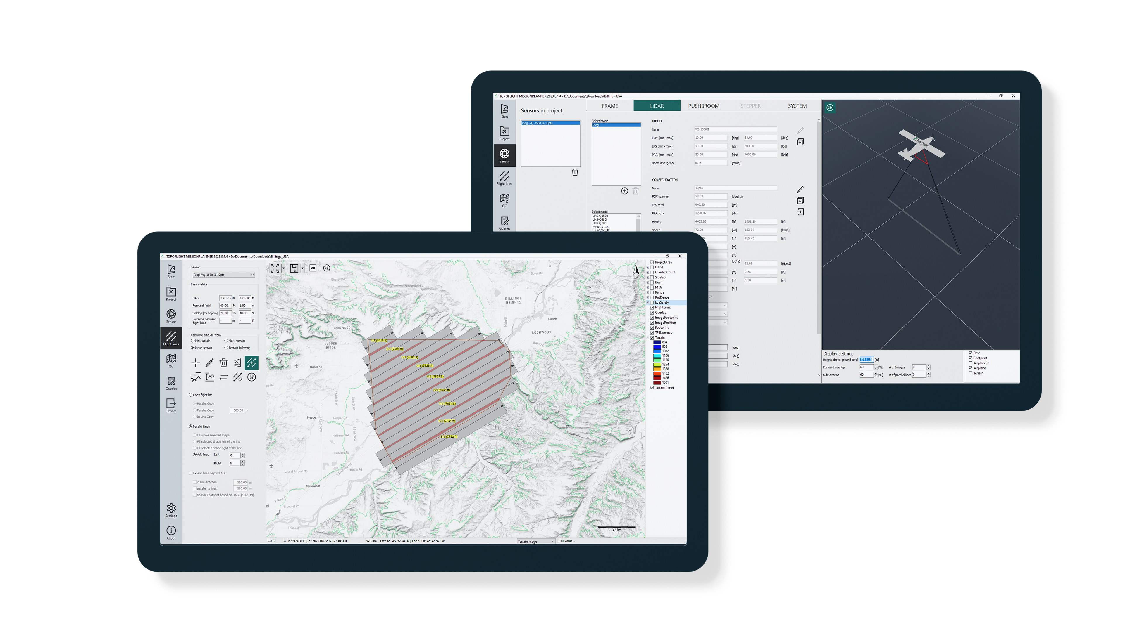
Key Features
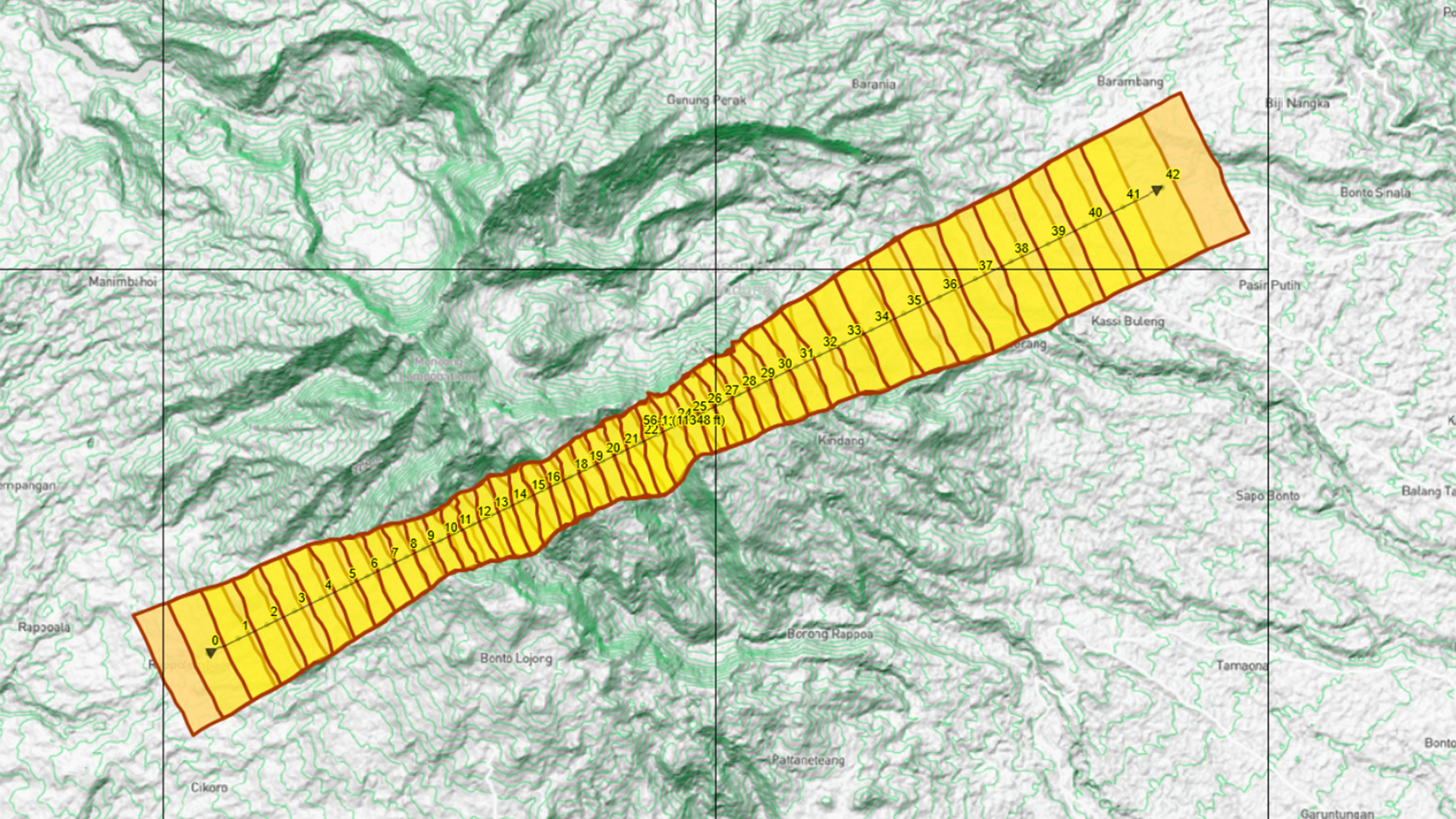
3D Flight planning
MISSIONPLANNER considers terrain elevation when calculating optimal solutions.
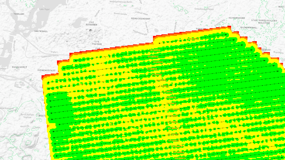
Quality control
Use quality control maps to ensure that the flight plan meets your requirements.
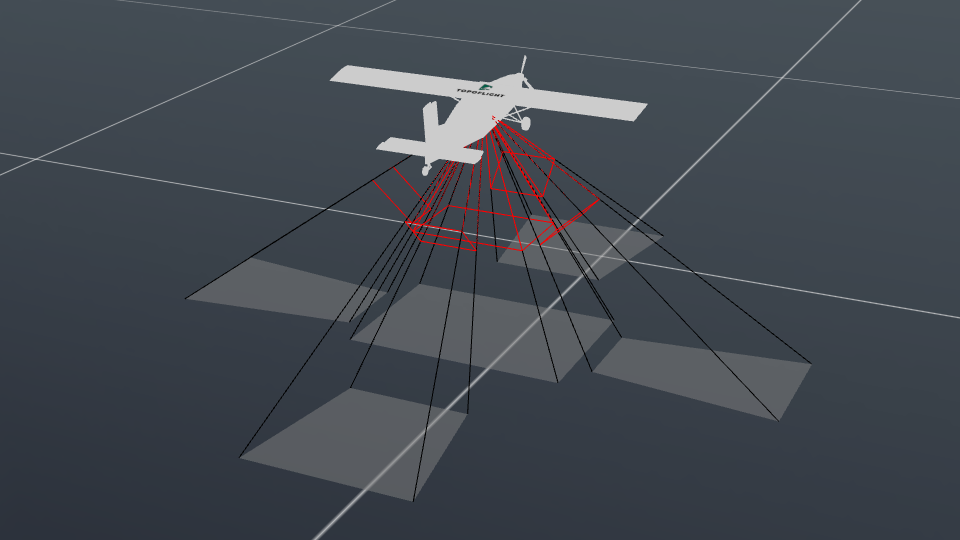
Diverse sensor compatibility
TOPOFLIGHT supports various sensor types, including LiDAR scanners, frame cameras, linear cameras, and multi-head systems.
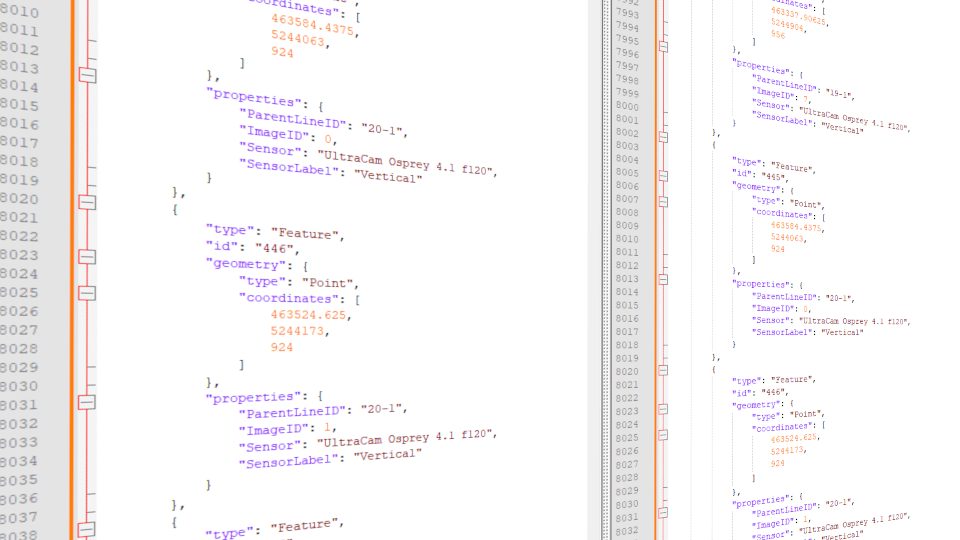
Open formats
Our primary exchange format is GeoJSON. Edit with ease, create seamlessly with your preferred software, integrate across diverse platforms.
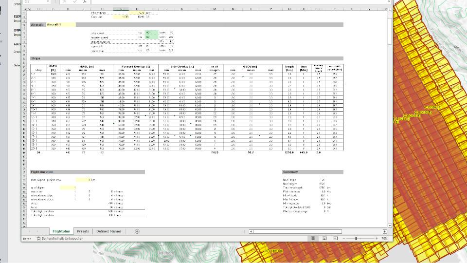
Cost management
Effortlessly export your flight plan to Excel to instantly calculate project costs and generate a quote.
Products
Latest News
Get in touch with us
Your way to the right contact person
Thank you for your interest in TOPOFLIGHT. Do you have any questions about our products?
Feel free to reach out to us anytime using our contact form. We are dedicated to matching your request with the appropriate contact person and ensuring you receive a knowledgeable response.
TOPOFLIGHT AG
Gemeindemattenstrasse 4
CH-3860 Meiringen, Switzerland
Phone: +41 33 972 30 30
info@topoflight.com
Your way to the right contact person
Thank you for your interest in TOPOFLIGHT. Do you have any questions about our products?
Feel free to reach out to us anytime using our contact form. We are dedicated to matching your request with the appropriate contact person and ensuring you receive a knowledgeable response.
TOPOFLIGHT AG
Gemeindemattenstrasse 4
CH-3860 Meiringen, Switzerland
Phone: +41 33 972 30 30
support@topoflight.com
Technology partners and resellers
