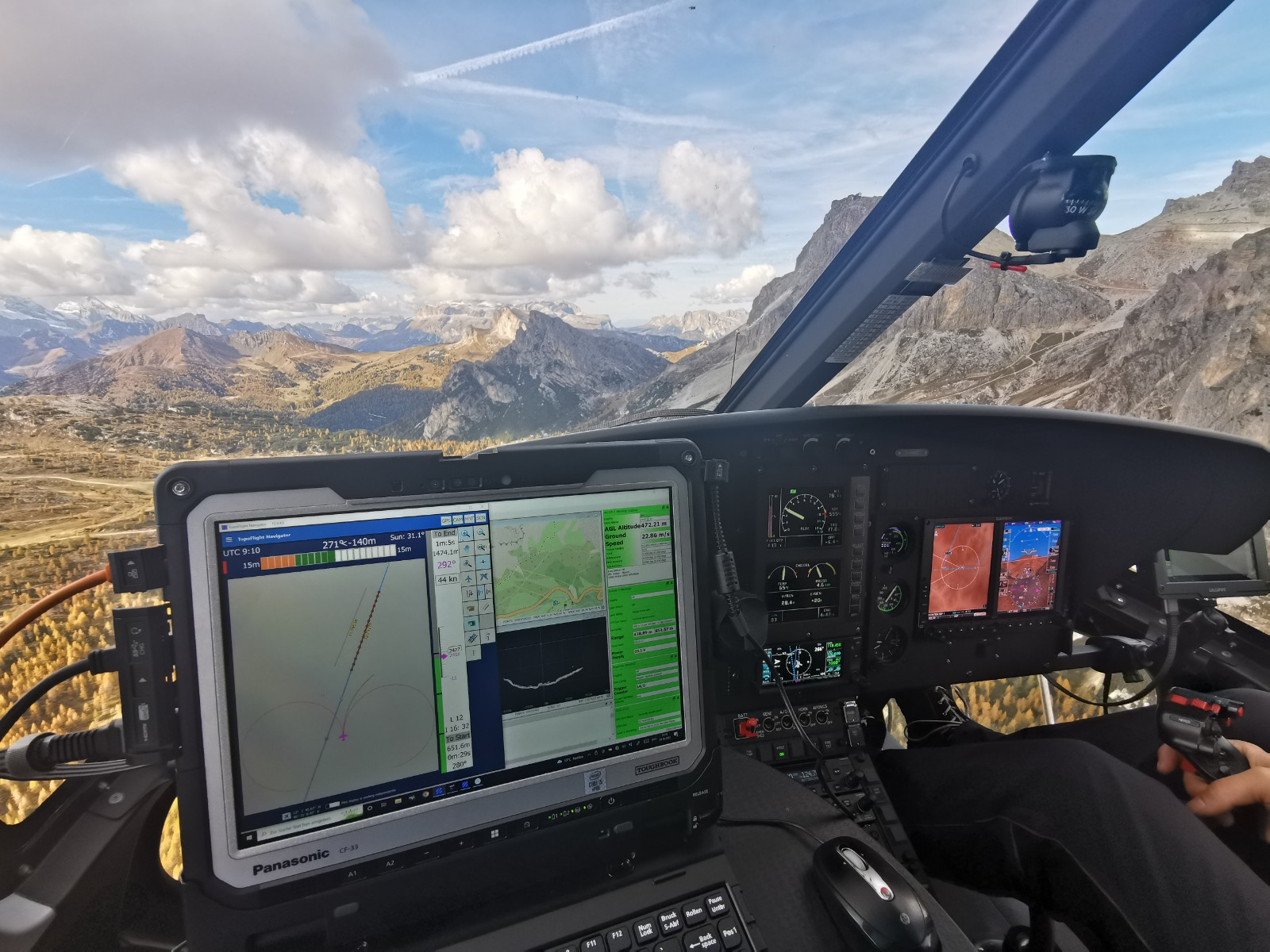
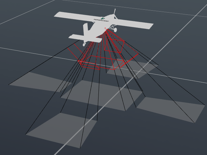
TOPOFLIGHT software enables the seamless integration of multiple sensors into a cohesive, singular unit.
As the range of aerial survey platforms continues to expand, including lightweight aircraft, standard planes, and helicopters, system integrators must devise methods to seamlessly integrate sensor components into a cohesive unit for efficient ground data collection from the air.
Key features
Various sensors
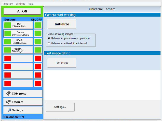
different types of sensors can be controlled in TOPOFLIGHT products.
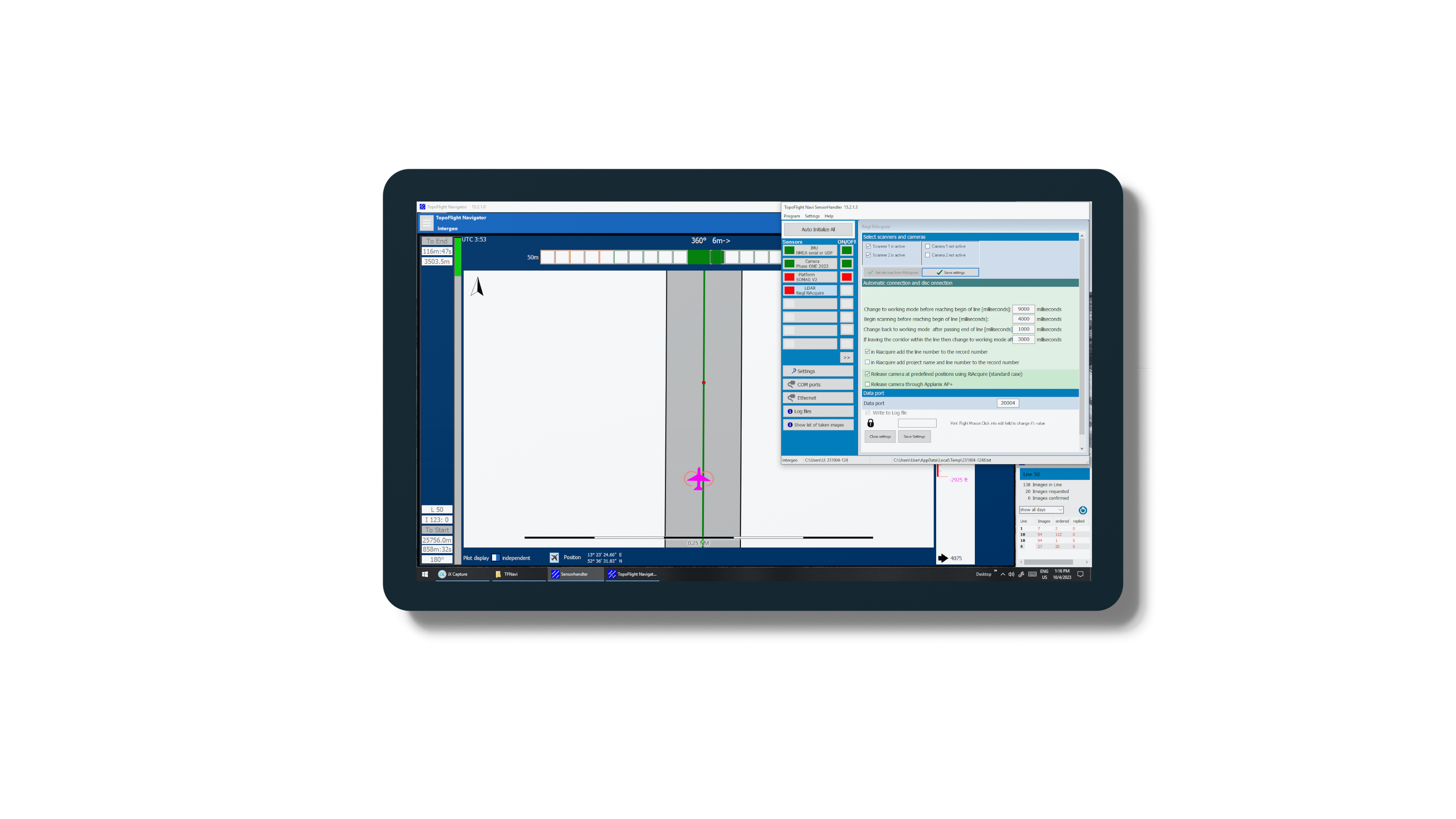
SENSORHANDLER
In the software SENSORHANDLER which is part of NAVIGATOR, the sensors are controlled via different communication standards.
Sensor state
Condition of the sensors always in focus – even under difficult conditions. (Image: AltoDrones, Italy)
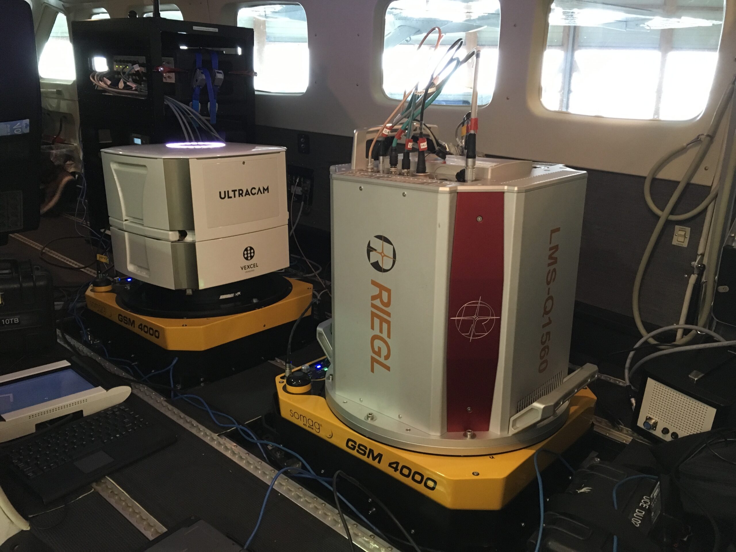
Multi sensor systems
The TOPOFLIGHT software can also handle several simultaneously operated sensors.
Key features at a glance

Different sensor types
We support LiDAR scanners , Imaging sensors, IMU, GNSS, mount platforms and also already integrated systems.
We support LiDAR scanners , Imaging sensors, IMU, GNSS, mount platforms and also already integrated systems.

Protocol
Various protocols have already been implemented and new ones are constantly being added.
Various protocols have already been implemented and new ones are constantly being added.

Standards
Standards like NMEA are supported.
Standards like NMEA are supported.

Simulation
A flight can be simulated. Testing of sensors can thus take place in the office or in the hangar.
A flight can be simulated. Testing of sensors can thus take place in the office or in the hangar.

Logging
Communication with the sensors is logged continuously. This simplifies troubleshooting.
Communication with the sensors is logged continuously. This simplifies troubleshooting.

Real time information
The status of the sensor reaches the user in real time. Quick intervention is therefore possible.
The status of the sensor reaches the user in real time. Quick intervention is therefore possible.
Resources
Software documentation
This document gives an overview on features and benefits of the software
List of supported sensors
Access a comprehensive list of sensors supported by TOPOFLIGHT here.
Get in touch with us
Your way to the right contact person
Thank you for your interest in TOPOFLIGHT. Do you have any questions about our products?
Feel free to reach out to us anytime using our contact form. We are dedicated to matching your request with the appropriate contact person and ensuring you receive a knowledgeable response.
TOPOFLIGHT AG
Gemeindemattenstrasse 4
CH-3860 Meiringen, Switzerland
Phone: +41 33 972 30 30
info@topoflight.com
Your way to the right contact person
Thank you for your interest in TOPOFLIGHT. Do you have any questions about our products?
Feel free to reach out to us anytime using our contact form. We are dedicated to matching your request with the appropriate contact person and ensuring you receive a knowledgeable response.
TOPOFLIGHT AG
Gemeindemattenstrasse 4
CH-3860 Meiringen, Switzerland
Phone: +41 33 972 30 30
support@topoflight.com
Products
Technology partners and resellers
