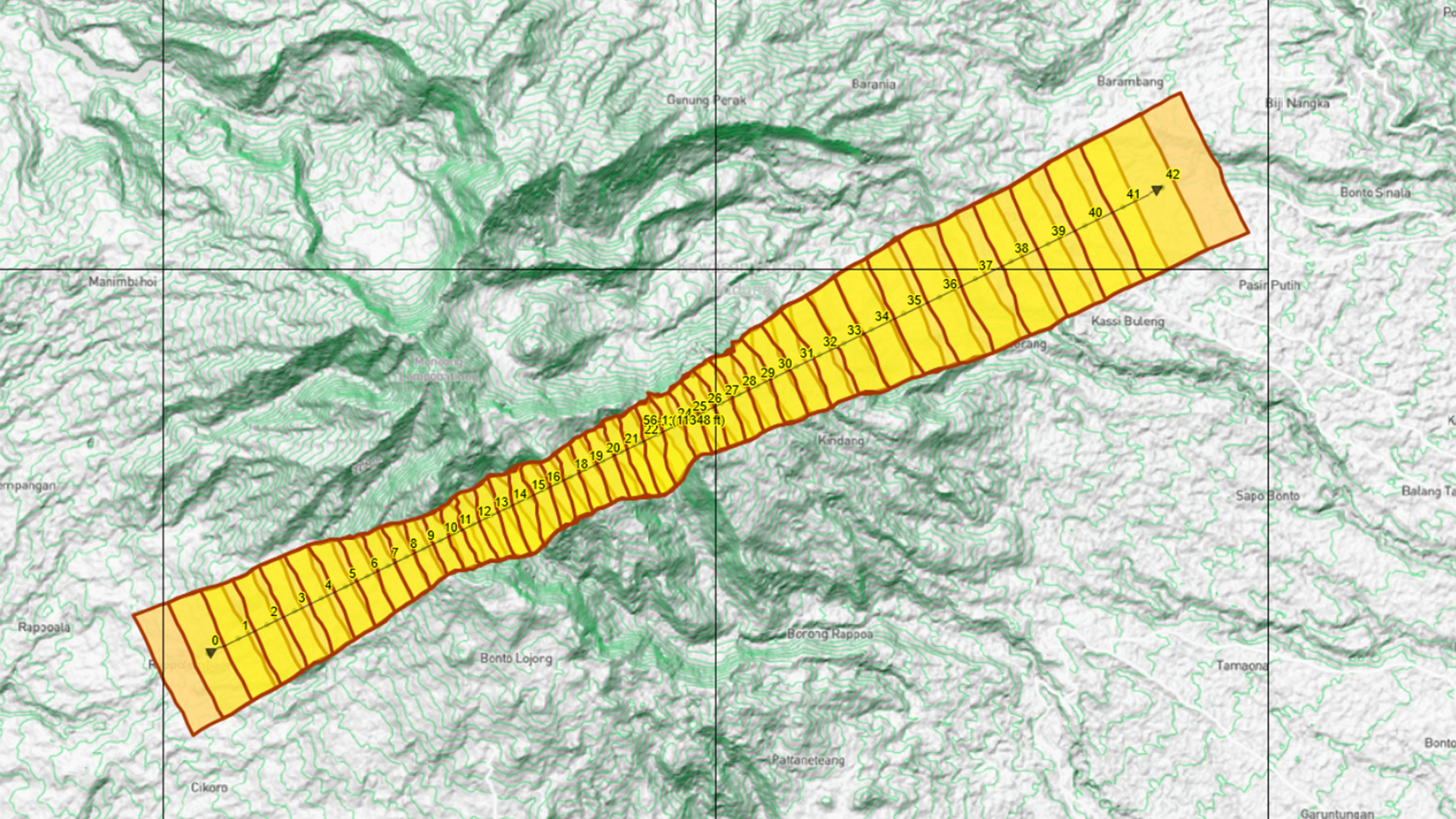
Fast and interactive application to create flight plans according to your specific requirements, even in challenging varied terrain.
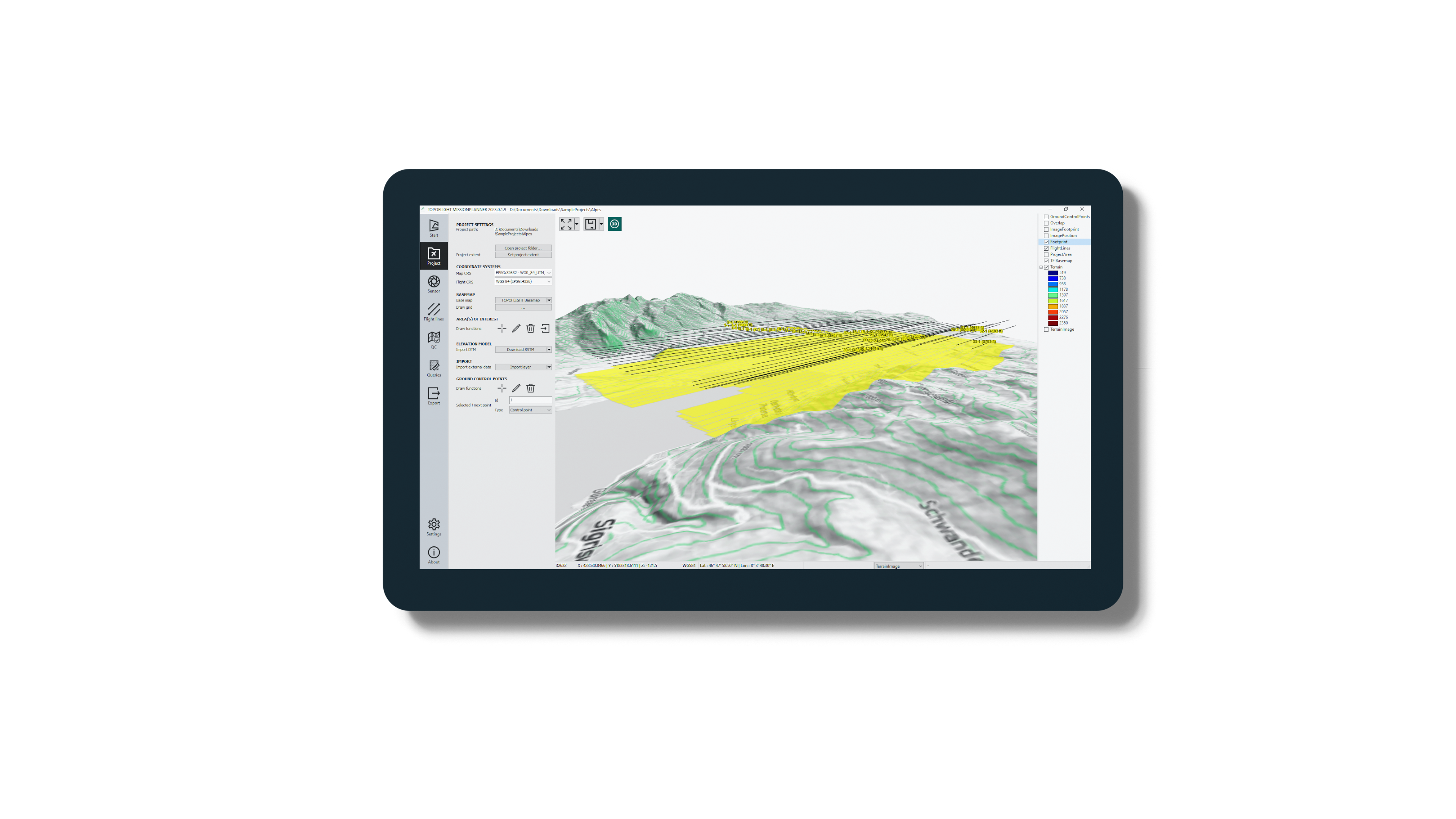
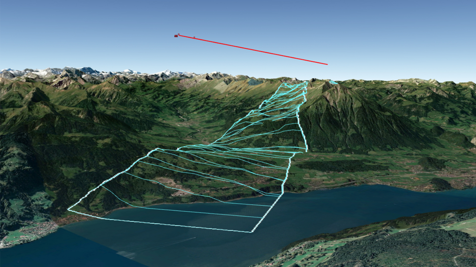
3D View
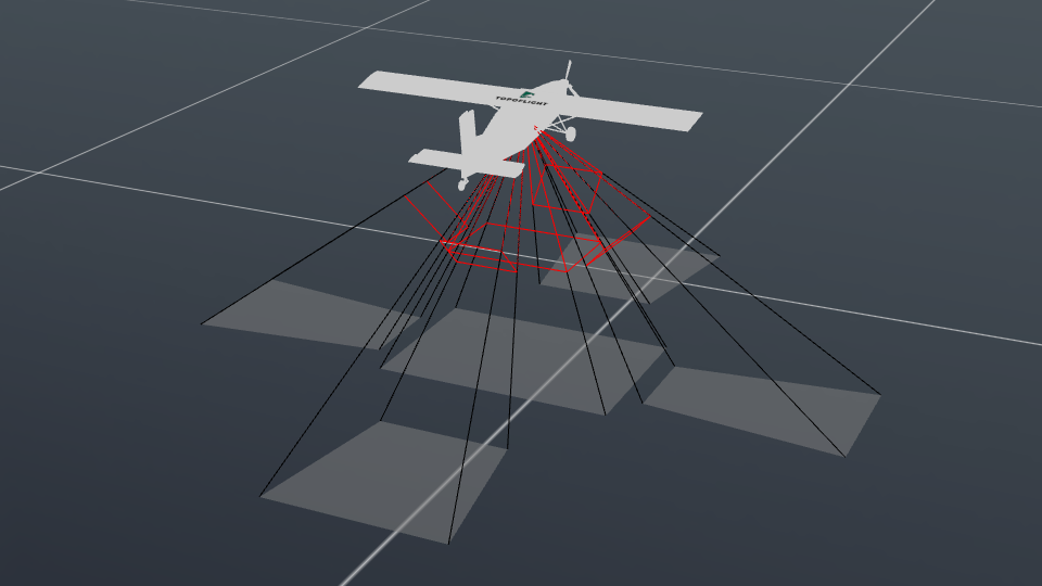
Visually inspect your flight plan in 3D.
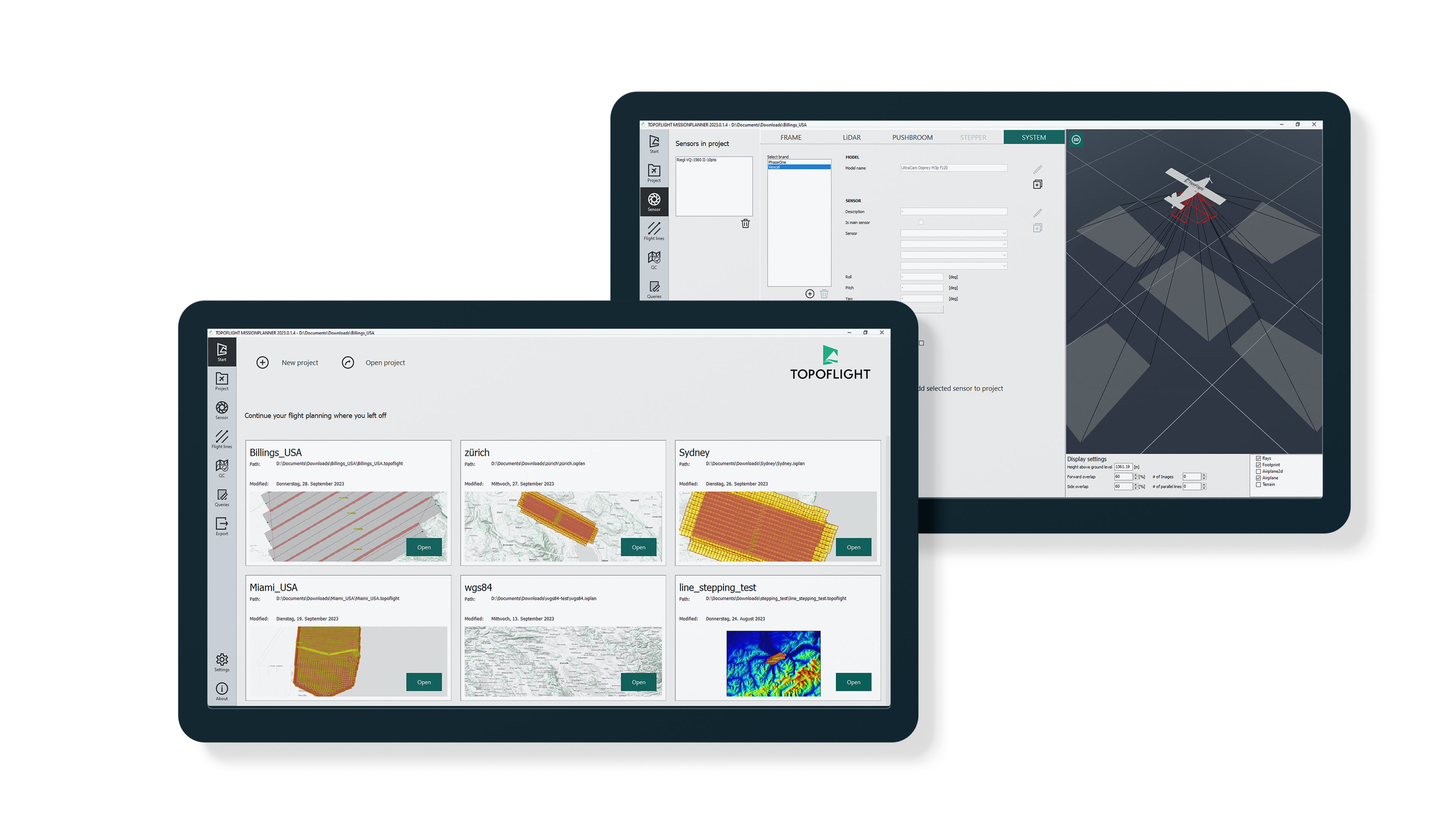
Continuously updated and customizable sensor database
Download provided sensor definitions and conveniently create custom sensor configurations directly within the application.
TOPOFLIGHT MISSIONPLANNER is an advanced 3D flight planning software for fast and interactive flight plan design. By incorporating digital elevation models, it ensures optimal outcomes and reduces the number of required images, subsequently minimizing the costs associated with flight missions. The software provides diverse export interfaces for seamless integration with a wide range of flight management systems.
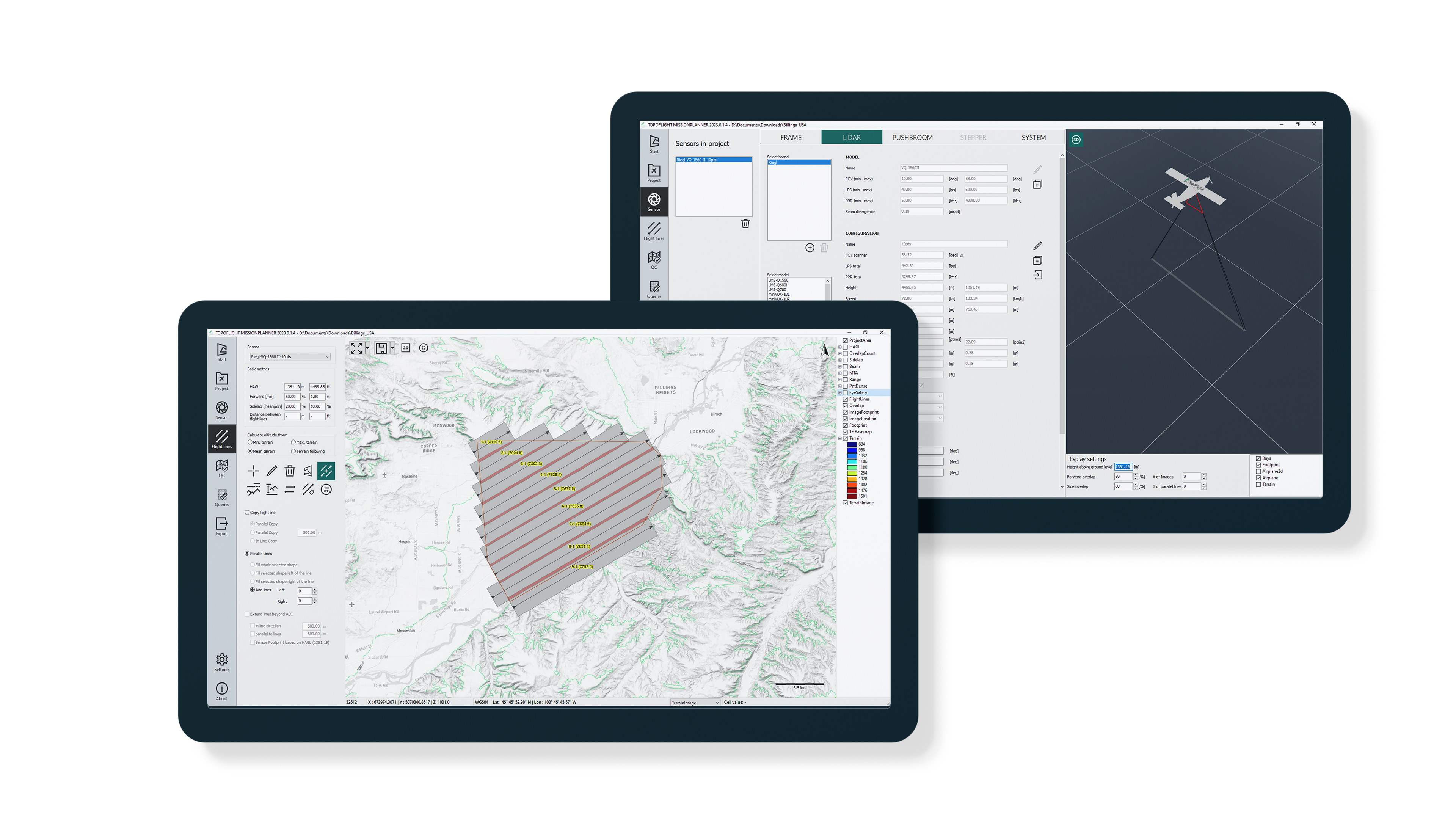
Designed for planning both photogrammetry and LiDAR missions, TOPOFLIGHT MISSIONPLANNER supports a variety of sensors, including frame, line, and LiDAR sensors. The software conveniently presents results through maps and tables, offering a comprehensive overview. Furthermore, it includes features for calculating project costs, streamlining the process of generating accurate quotations.
Key features
Flight planning
Advanced 3D application for optimized flight plans, even in challenging varied terrain.
Diverse sensor compatibility
TOPOFLIGHT supports various sensor types, including LiDAR scanners, frame cameras, linear cameras, and multi-head systems.
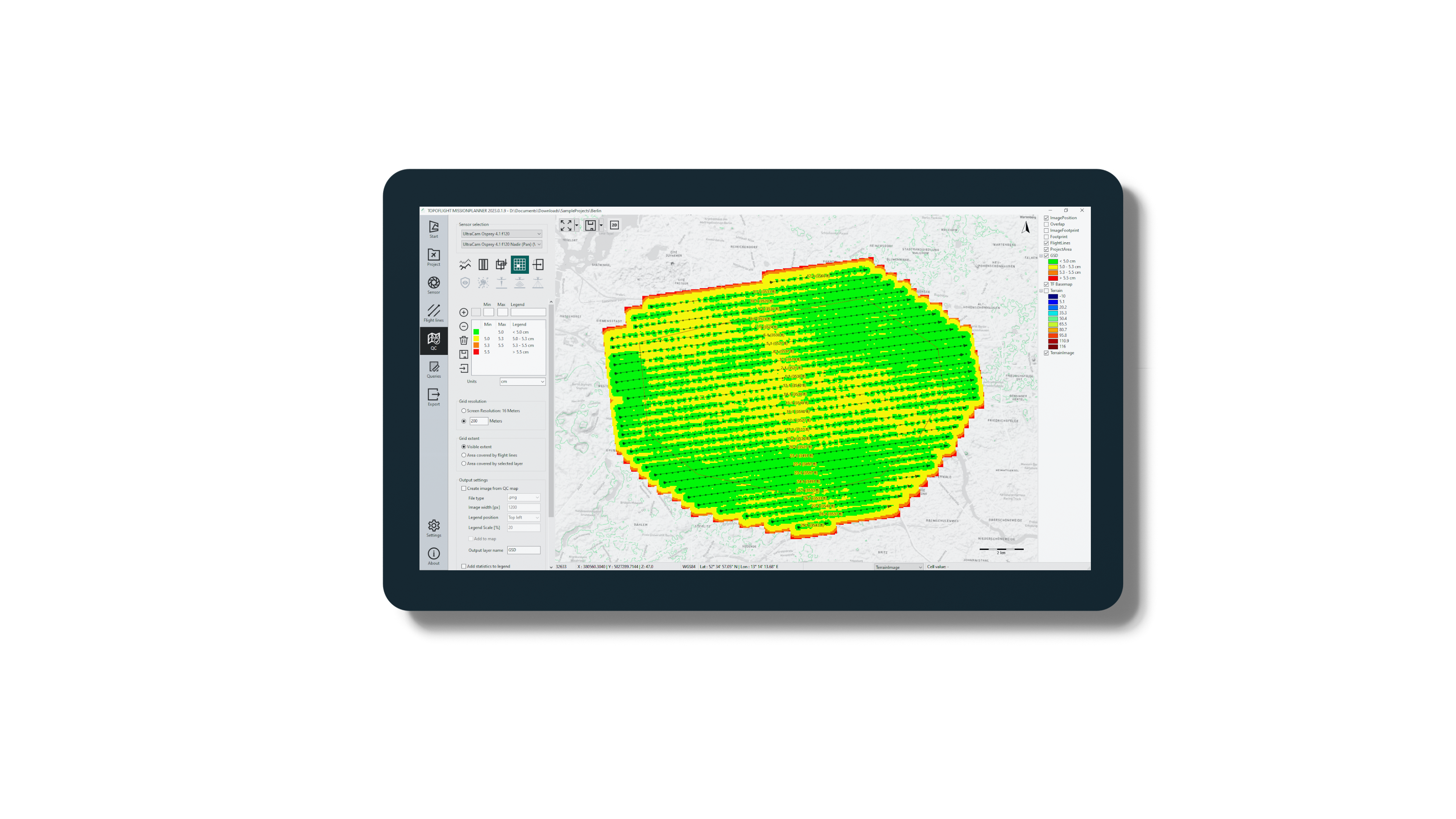
Quality control
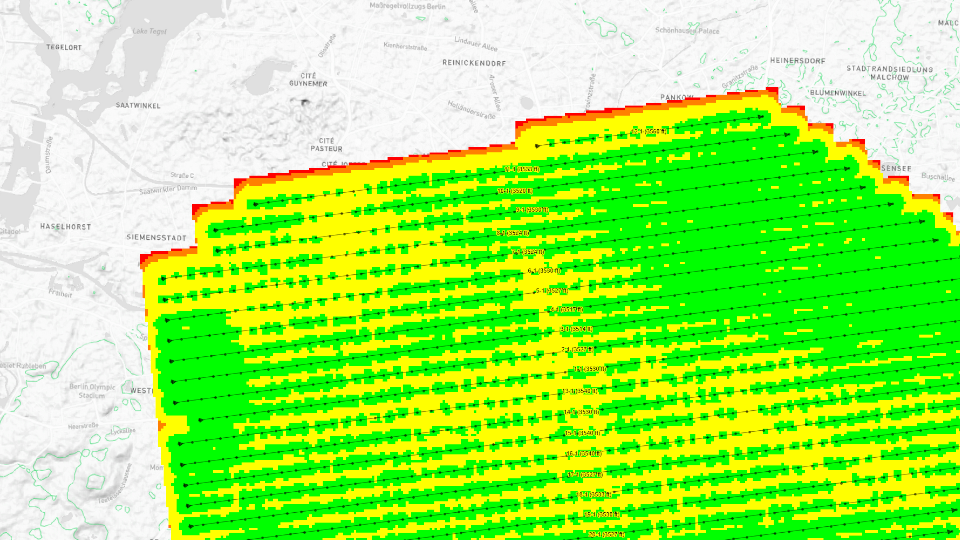
Use quality control maps to ensure that the flight plan meets your requirements.
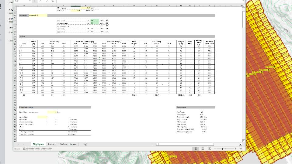
Cost management
Effortlessly export your flight plan to Excel to instantly calculate project costs and generate a quote.
Various export options
Export flight plans to formats like KML, GPS, TXT, and more.
Key features at a glance
Follow the navigation bar from top to bottom to successfully plan a project
Interactive 3D view View the sensor alignment in a 3d scene
Sensor database Update the sensor database from our online API and extend it with your configurations

Navigation bar
Effectively mirrors the workflow, providing intuitive access to essential functions and features.
Effectively mirrors the workflow, providing intuitive access to essential functions and features.

Default basemap
When initiating a project, an automatic default basemap is provided.
When initiating a project, an automatic default basemap is provided.

SRTM heights
Seamless prebuild integration of SRTM elevation data.
Seamless prebuild integration of SRTM elevation data.

Coordinate reference system selection
Choose the optimal or preferred coordinate reference system for your project.
Choose the optimal or preferred coordinate reference system for your project.

Manage sensor configurations
Effortlessly edit and manage your sensor configurations directly within the application.
Effortlessly edit and manage your sensor configurations directly within the application.

Quality control maps
Verify flight lines using a variety of quality control maps to ensure the flight plan meets your criteria.
Verify flight lines using a variety of quality control maps to ensure the flight plan meets your criteria.

3D View
Visually inspect your flight plan and the terrain in 3D.

Various export options
Export flight plans to formats like KML, GPX, TXT, and more.

Resources
Software documentation
You can access our online documentation at this location.
Licensing documentation
Detailed information on the licensing process is available here.
Download legacy release (version 15)
Go here to download our legacy software release.
Download Sentinel RTE
The Sentinel Run-time Environment enables communication between the Sentinel protection key and our software.
Download Sentinel HASP RUS
The Sentinel Remote Update System utility is used to update license data remotely for deployed Sentinel protection keys.
Free trial license
Get a 10-day trial license and test our MISSIONPLANNER for free.
End-User License Agreement (“EULA”)
TOPOFLIGHT grants you the rights described in this EULA provided that you comply with all terms and conditions of this EULA.
Get in touch with us
Your way to the right contact person
Thank you for your interest in TOPOFLIGHT. Do you have any questions about our products?
Feel free to reach out to us anytime using our contact form. We are dedicated to matching your request with the appropriate contact person and ensuring you receive a knowledgeable response.
TOPOFLIGHT AG
Gemeindemattenstrasse 4
CH-3860 Meiringen, Switzerland
Phone: +41 33 972 30 30
info@topoflight.com
Your way to the right contact person
Thank you for your interest in TOPOFLIGHT. Do you have any questions about our products?
Feel free to reach out to us anytime using our contact form. We are dedicated to matching your request with the appropriate contact person and ensuring you receive a knowledgeable response.
TOPOFLIGHT AG
Gemeindemattenstrasse 4
CH-3860 Meiringen, Switzerland
Phone: +41 33 972 30 30
support@topoflight.com
Products
Technology partners and resellers
